Kedarkantha Trek
About this trek
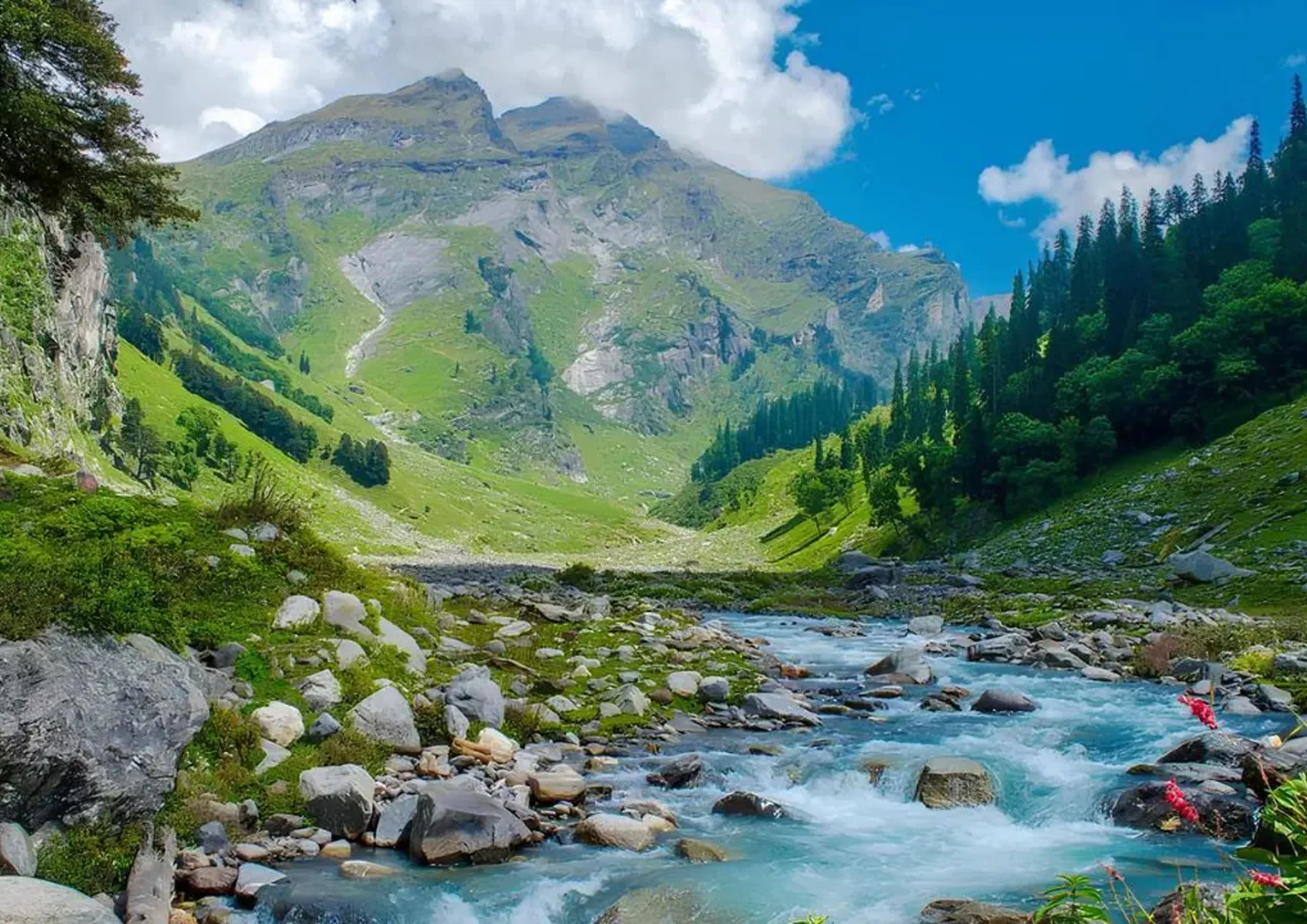
The Kedarkantha Trek is one of Uttarakhand’s most iconic winter and all-season treks — a perfect blend of mythology, forest trails, alpine camps, and a rewarding summit climb. Rising to 12,500 ft, Kedarkantha sits about 20 km from the village of Sankri, offering some of the most dramatic views of the Himalayan ranges.
The name “Kedarkantha” loosely translates to “Throat of Lord Shiva”, and the region is deeply intertwined with legends from the Mahabharata. According to local belief, this was one of the places where the Pandavas sought Lord Shiva’s blessings after the Kurukshetra war.
Mythology aside — the trek is known for its dense pine forests, snowy winter trails, peaceful campsites, and a spectacular 360° summit view showcasing Swargarohini, Black Peak, Bandarpoonch, and Ranglana.
Short, scenic, and incredibly rewarding — Kedarkantha is ideal for beginners, families, solo trekkers, and experienced hikers wanting a quick Himalayan escape.
- Guided trek
Experienced trek leader and support staff from base to summit.
- Small groups
Limited batch size for safety and personalised attention.
- Safety first
Equipment, permits and protocols for a secure trek.
- Cancellation policy
Flexible reschedule; see full terms at booking.
Itinerary
Your journey begins in Dehradun. The drive to Sankri (220 km / 9–10 hours) takes you through picturesque mountain roads, pine forests, apple orchards, and the beautiful Mori Valley along the Tons River. Reach Sankri (6,400 ft) by evening, freshen up, explore the quiet village, and rest for the night. Network connectivity is limited.
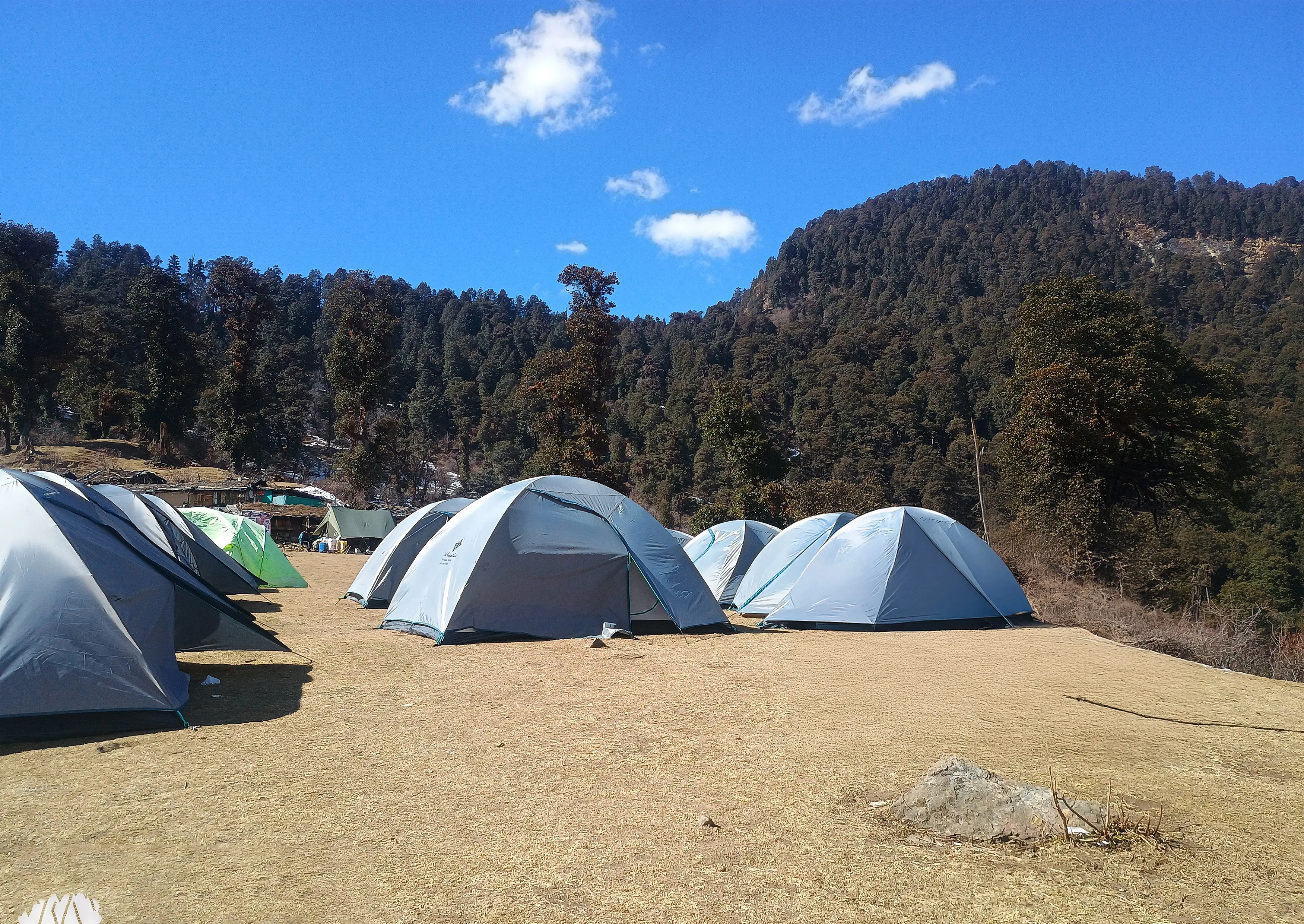
Begin your trek after breakfast. The trail climbs steadily from Sankri through thick pine forests, maple patches, and flowing streams. After about 4 hours of hiking, you’ll reach Juda Ka Talab (9,100 ft) — a serene lake surrounded by tall trees. Local legends say this lake formed when Lord Shiva dropped a strand of hair during meditation. Camp here and soak in the calm of the forest.
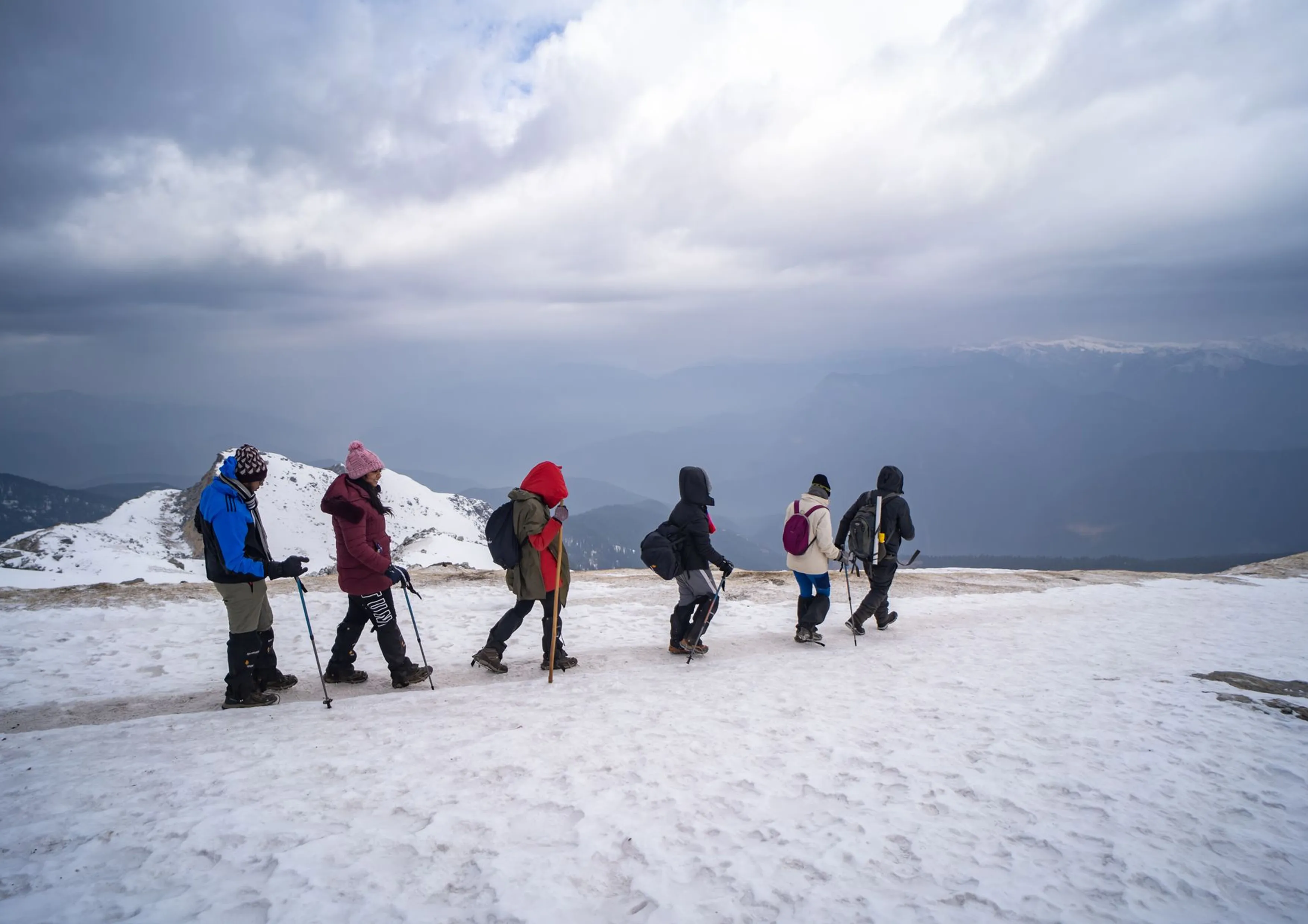
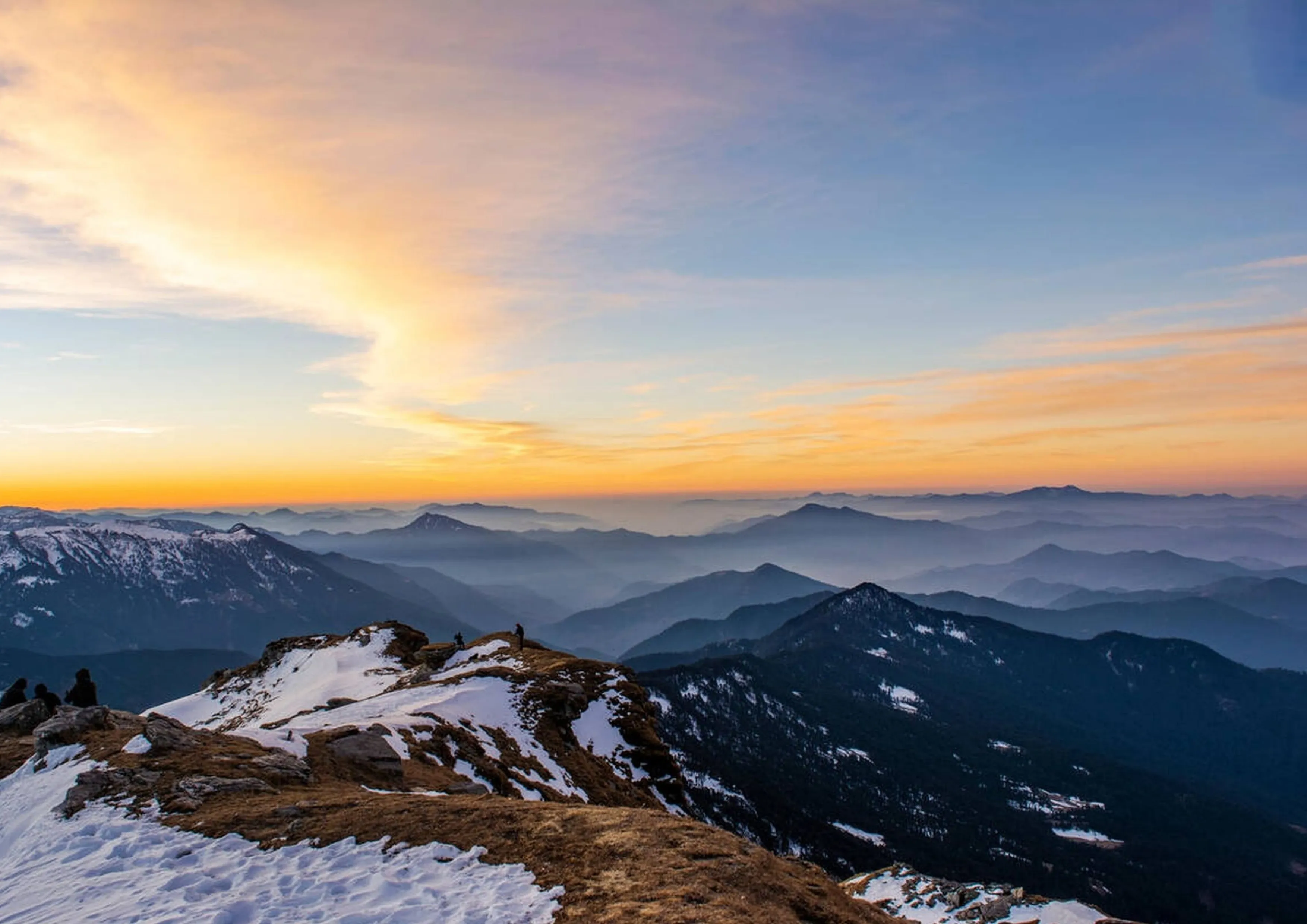
Today’s trail is short yet scenic. Ascend gradually through snow-covered clearings (in winter) and open forest sections to reach Kedarkantha Base Camp (11,250 ft). The campsite offers incredible sunset views and your first clear sight of Swargarohini, Bandarpoonch, Kala Nag (Black Peak), and Ranglana. Spend the evening acclimatizing and preparing for the summit attempt.
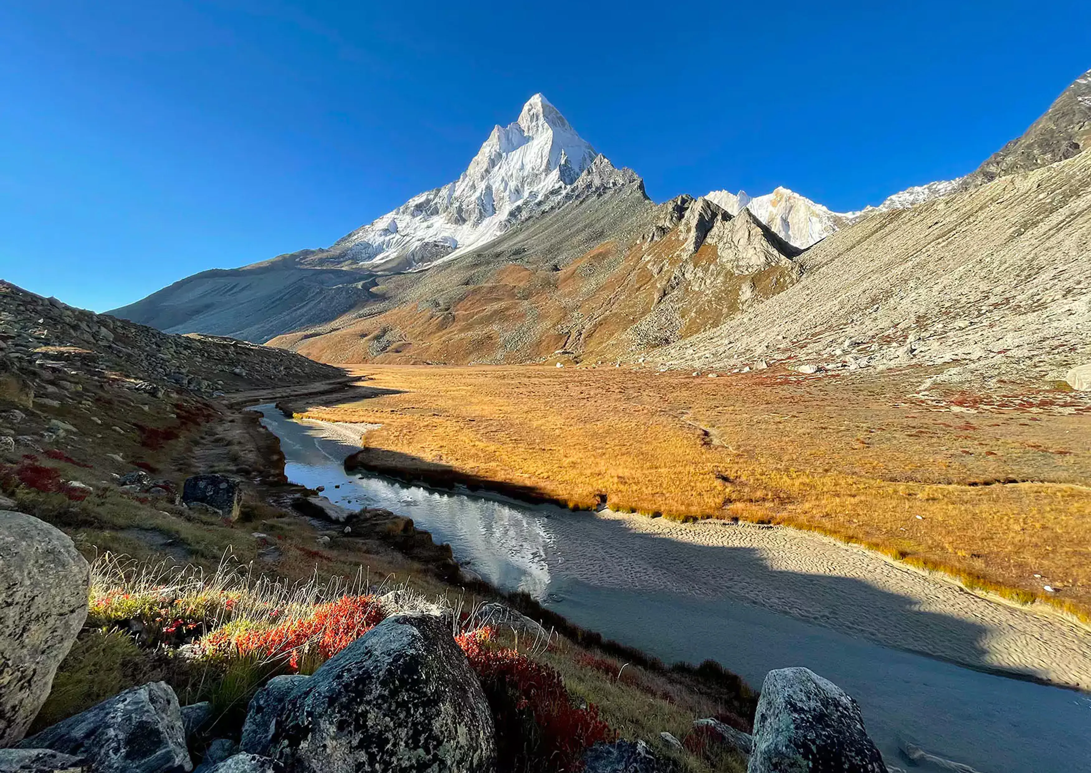
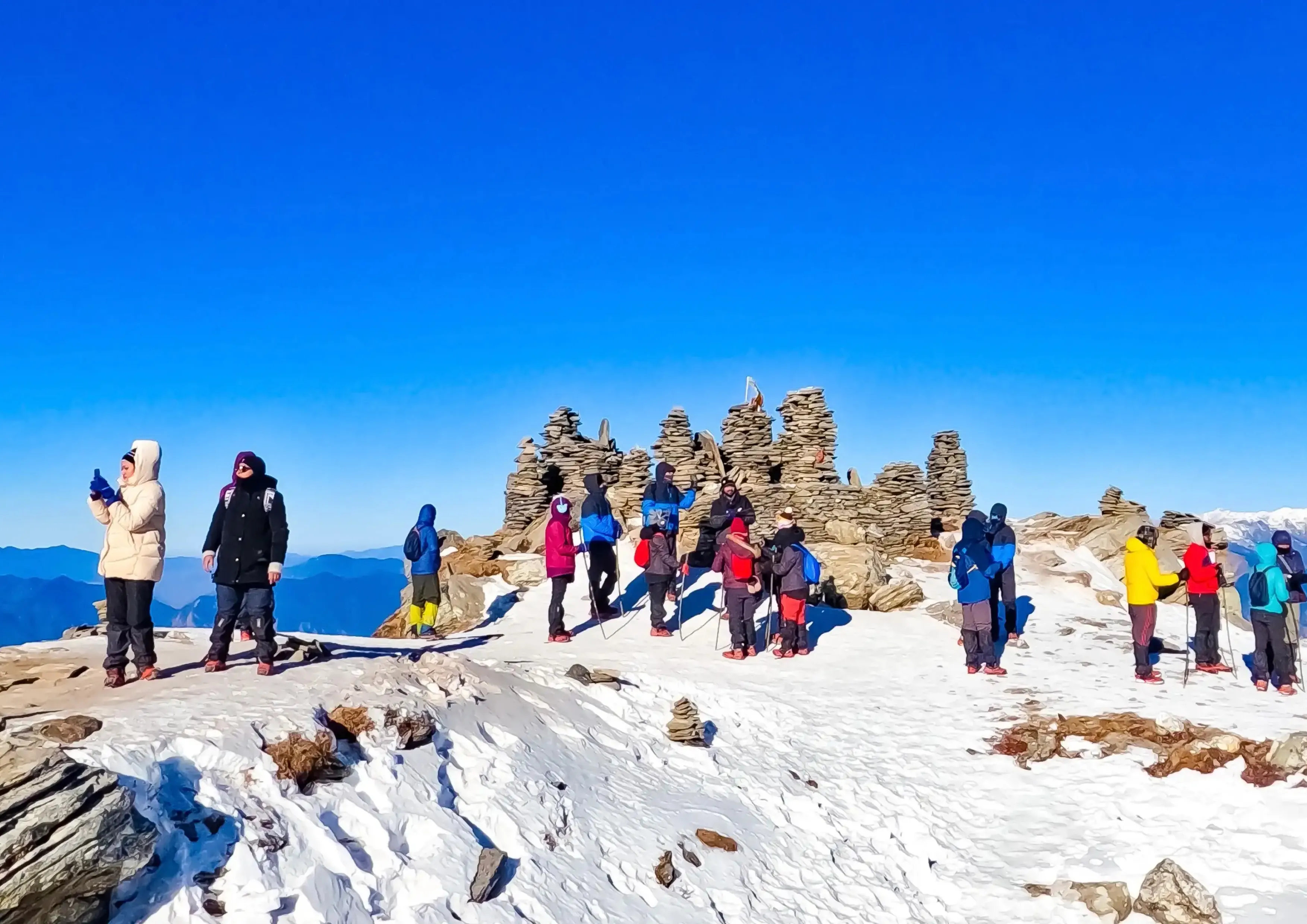
Start early — ideally before sunrise — for the summit push. The trail zig-zags upward and eventually opens into a stunning ridge walk leading to the Kedarkantha Summit (12,500 ft). At the top, a small temple dedicated to Shiva, Parvati, and Ganesh stands quietly against a backdrop of glowing Himalayan peaks. The 360° panorama from the summit is unmatched in this region. After spending time at the summit, descend carefully back to Base Camp for lunch and rest.
After breakfast, begin your descent to Sankri. The downhill trail winds through peaceful forests and open meadows. Reach Sankri by afternoon and enjoy your final evening with the group — stories, photos, and mountain nostalgia.
Depart after breakfast for your return journey to Dehradun. Expect to arrive by evening. Hold on to your memories — beautiful forests, starry nights, and that unforgettable summit sunrise.
Essential Gear Trek Checklist
- Rucksack (40–50 L)
- Trekking shoes
- Warm layers & jacket
- Raincoat / windcheater
- Sun cap & sunscreen
- Water bottle (2 L)
- Head torch
- Personal medication
- ID
Inclusions
Accommodation in guesthouses and tents (Day 1–6).
Nutritious vegetarian meals from Day 1 dinner to Day 6 breakfast.
Round-trip transportation Dehradun ↔ Dehradun (if opted).
Forest permits, entry fees, and camping charges.
High-quality tents, -10°C sleeping bags, gaiters, microspikes & ropes.
Experienced trek leader, guides, cooks, and support staff.
Exclusions
Personal luggage carrying or porter charges.
Emergency evacuation or additional medical costs.
Bottled water, snacks, or personal beverages.
Transport cost from Dehradun to Sankri (₹1,000–₹1,500 approx., if not included).
Map
Trek region: Uttarakhand. Contact us for exact reporting point and route details.